You want to geolocate an image? A guide on how to.
Sometimes you may see an image and you want to know where it was taken. This guide teaches you the basics on how to go about it
Sometimes you may see an image or video and it is super interesting and you may want to know where the image is from. Geolocation is an interesting field that has helped police nab criminals, helped families recreate their favourite moments in places they visited long ago or when they were young and mapping conflict zones like how GeoConfirmed does.
One of the most popular figures in this area, Trevor Rainbolt, can locate you while you are on a plane, while gatekeeping that posh and ambient restaurant or even gatekeeping a lake! In fact he has been immortalized as an anti-gatekeeping hero meme.
So how does he do it? Let's dive in.
Geography
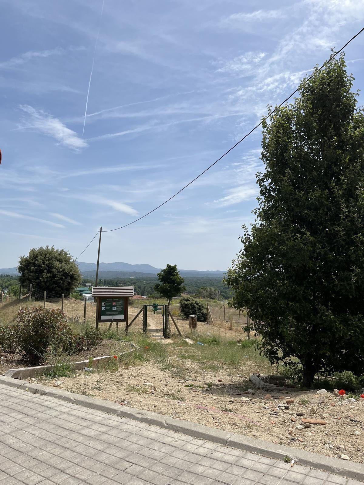
The most basic clue is the geography of a picture/video or of one who posted the picture/video. This gives you a rough clue to help you get started. Let's take the example of the picture below that was part of a challenge.
For geolocation, you have to do a lot of memorization. You have to know what peculiar features are available in each location.
For example, EU countries have a license plate that has a blue strip on the left featuring the country's abbreviation on the lower side and the EU stars on the upper side.
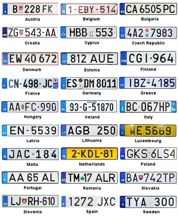
According to the image above, you can easily geolocate a car which has a yellow plate as from either Netherlands or Luxembourg. This helps you narrow your choices as you go down.
Other elements to be considered include street signage, bollards, utility poles, mountains, architectural features, vegetation, license plates, and the designated side of the road for driving which is either left hand drive or right hand drive. With that, you are halfway to correctly identifying the location of your image or video.
Features
Now back to the image above. First of all, what I noticed is the mountains in the background, the pavement, the vegetation, and the sign board.
First of all, I searched the vegetation on Google Image Search. Most phones and browsers have this feature, Android has Circle to Search and Bing has Visual Search. Other alternatives to do this include Yandex Image Search and TinEye. TinEye has drastically depreciated but it's a good starting point. Yandex is good for non-Western images and images from Russia. There are other AI alternatives but I haven't yet tested them because Google Image Search is reliable and constantly improving. It is also integrated with Gemini AI.
This showed me that the vegetation is predominant in the Mediterranean region. This narrowed my search.
The next thing I noticed, was the image of a dog symbol and the word "Canino" which sounded like a Spanish word. So with that, I started looking around and I found the full word "Parque Canino" which translates to Dog Park.
Narrowing down
So with that information at hand, you already know the country is Spain, because it matches your preliminary findings (Mediterranean, Spanish words). Now you begin the process of narrowing down.
First of all, you determine how may dogs parks are there in Spain. Of course, there would be several. Here is where reverse image search comes. You take your picture and try and reverse search and see if you can get it or get something similar or something that closely resembles it.
After a reverse search, I stumbled on a similar image from San Lorenzo de El Escorial. This takes several hours because you are poring over a large area and it's looking for a needle in a haystack. Patience is required here.
Elimination
Now that you have a particular location, you start the elimination method. This is where you find similar areas and then start truncating them one by one if they don't strictly match with your criteria.
Luckily, the municipality in question had an interactive map of all their dog parks. Now this is where you get to eliminate all your options until you remain with your desired location. This can done via Google Street View through Google Earth and where Google Street View is not available, Maxar offers high resolution satellite images that are updated regularly.
So using Google Street View, I was able to locate the exact park and the end results are below.
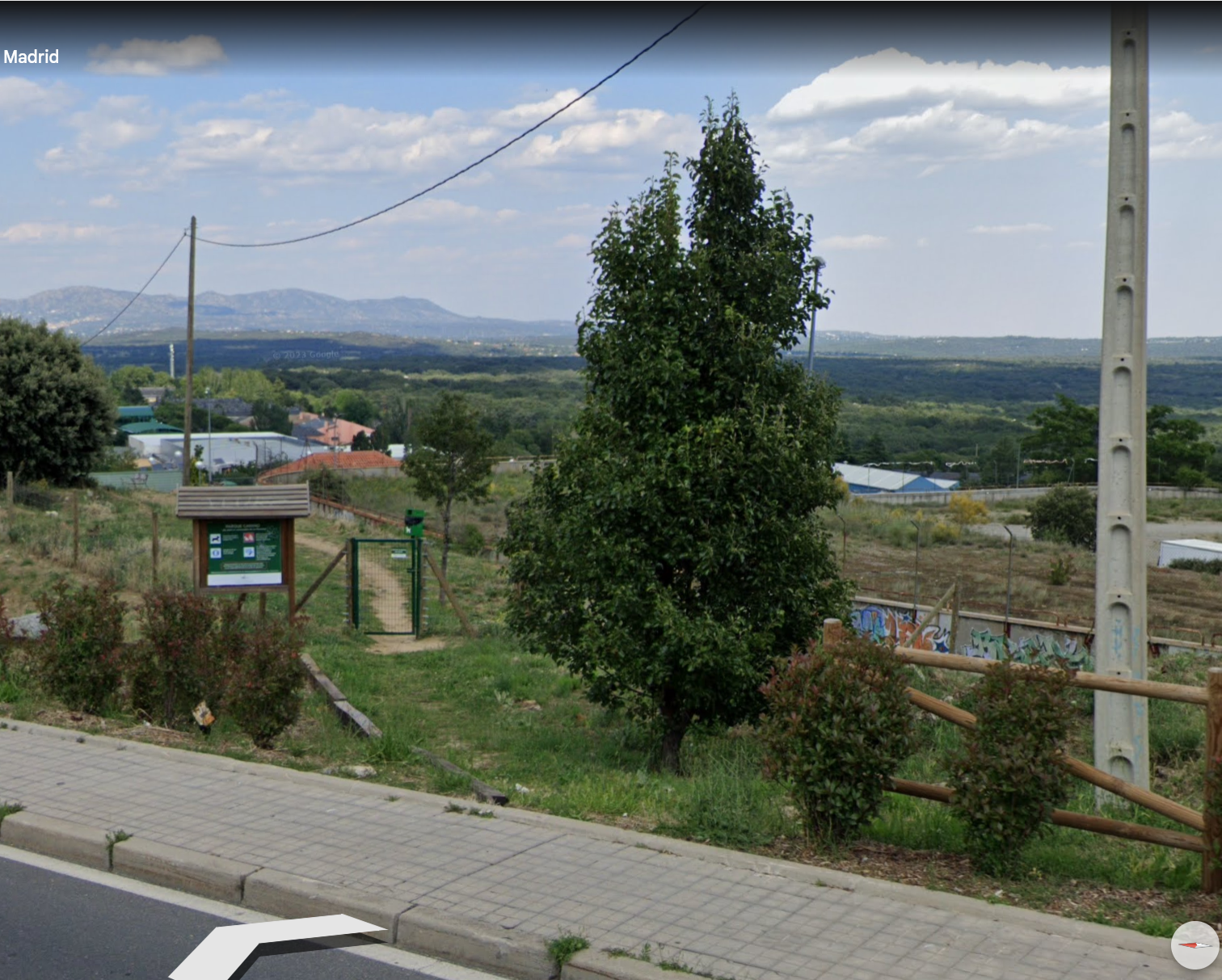
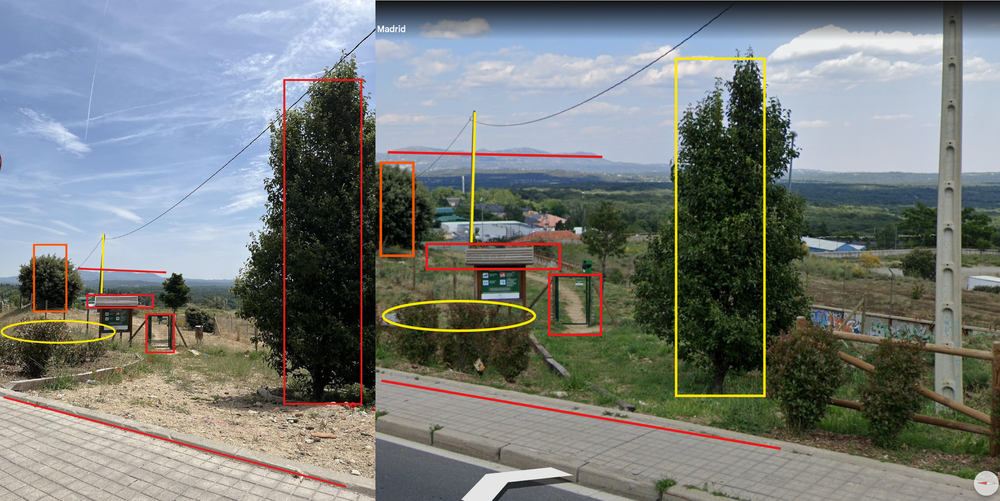
Now that's how you are able to geolocate an image.
Takeaway.
Image geolocation is both easy peasy and super rock hard. Sometimes Google Street View imagery may represent updated imagery which erases key features while other times it is grainy as hell and you can't locate anything at all. In other countries, there is no Google Street View imagery and you have to rely on satellites images to correctly locate your images.
You must spend a lot of hours learning and re-learning some key features that can help you succeed in this field. For example, snow is rarely found in Africa or if it does, it is seasonal and mostly concentrated in the northern and southern parts of the continent. The US is known for big cars and huge buildings. A US like country but with small cars and locations is most likely to be Australia or New Zealand. A desert-ish location is most likely to be in the Middle East. A wide and empty expanse is most likely in Central Asia around Kazakhstan/Mongolia/Uzbek etc. Also, in such region, Google Maps cars have something that look like camping materials on top.
To help you with that, you can play Geoguessr game that helps you learn various locations which can sharpen your mind and also help you stay on top of the game.
Lastly, you can follow the following accounts that do geolocation to help you learn more. The accounts are no exhaustive but a small sample to help you learn and connect. Otherwise the geolocation community is large and ever growing.
- Christiaan Triebert
- Trevor Rainbolt
- Twist
- Power Pigeon
- Zvi Adler
- Anno Nemo
- Chris Osieck
- Geo Raccoon
- Middle East Buka
Lastly, practice makes perfect.